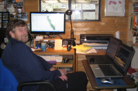
George Durkee

Biography
I've been a backcountry ranger for the National Park Service for over 40 years. In the last 10 years, I've been part of a group of emergency services professionals from across the country to give people the training and tools to understand and use Geographic Information Systems (GIS) more effectively in their operations, such as search and rescue (SAR) and fire incident mapping. Working with Jeff Tolhurst of the Columbia College Earth Science/GIS Department, we’re developing a series of classroom and online courses to familiarize people with the tools and potential for more widespread use of GIS. These courses will be for anyone who wants to better understand mapping, coordinate systems and where they are on the planet.
Recently, with Columbia College, UC Merced, and county GIS professionals we’ve formed the Yosemite All Hazard GIS advisory group to help the counties and communities in the greater Yosemite area use maps, data, and online sharing apps such as ArcGIS Online to better prepare for fire and other emergencies.
In 2011, our search and rescue workgroup was chosen for the Excellence in Public Safety Award by the National Association of GIS and Public Safety (NAPSG). In July of 2012, Jack Dangermond, President of ESRI, presented us with a Special Achievement Award in GIS.
Classes
Short Title: Web Mapping
Units: 1 FULLY ONLINE
Syllabus Here
ArcGIS Online (AGOL) is an easy to use application that enables the user to connect people, locations, and data using interactive maps. These maps can be instantly shared, either within your organization or to the public. AGOL maps can be used to tell a story of a trip – such as a vacation or hiking trip – or, as is increasingly becoming the case, used in business to analyze resident’s income, similar businesses in an area, or anything else for which government statistics are available. Users can also use simple to build apps to gather data in the field and upload to your map.
AGOL maps are also now the standard for getting emergency information out to the public in the event of road closures or evacuations. They are also used within a command center to give emergency workers up to the minute information on, for instance, a fire’s perimeter, location of responding resources, vulnerable populations who might need help evacuating and other information critical for decision makers.
Whatever your career choice or interest, this is an important class to take for almost any job. You may not have an immediate use for what we cover, but knowing it’s available to bring into your organization will give you a definite advantage now or in the future.
Short Title: ArcGIS: Creating a Basic Map
Start Date: 1/24/2022
End Date: 2/19/2022
Section Name:CGEOGR-63-4272
Start Date: 2/28/2022
End Date: 3/26/2022
Section Name:CGEOGR-61-4410
With Vanessa Glyn-Linaris, I am co-author of Using GIS in Wildland Search and Rescue. Although written for SAR, it is actually an excellent primer for anyone wanting to better understand the practical side of GIS, coordinate systems, using a GPS and mapping solutions.
Contact
Please feel free to contact me if you have any questions about any of my classes. It’s best to write me at: gedurkee@sonic.net to be sure I get the email in a timely way.
Courses I Teach
Web Sites
- Using GIS in SAR and Emergency Services - A Google forum for anyone interested in using GIS for emergency response. Posting requires approved membership.

